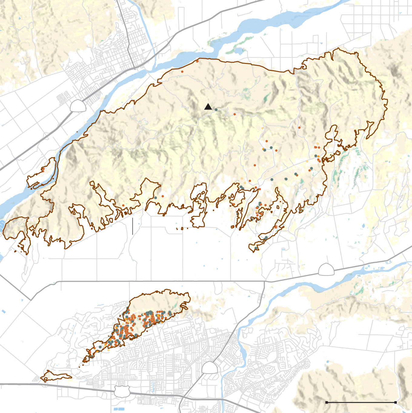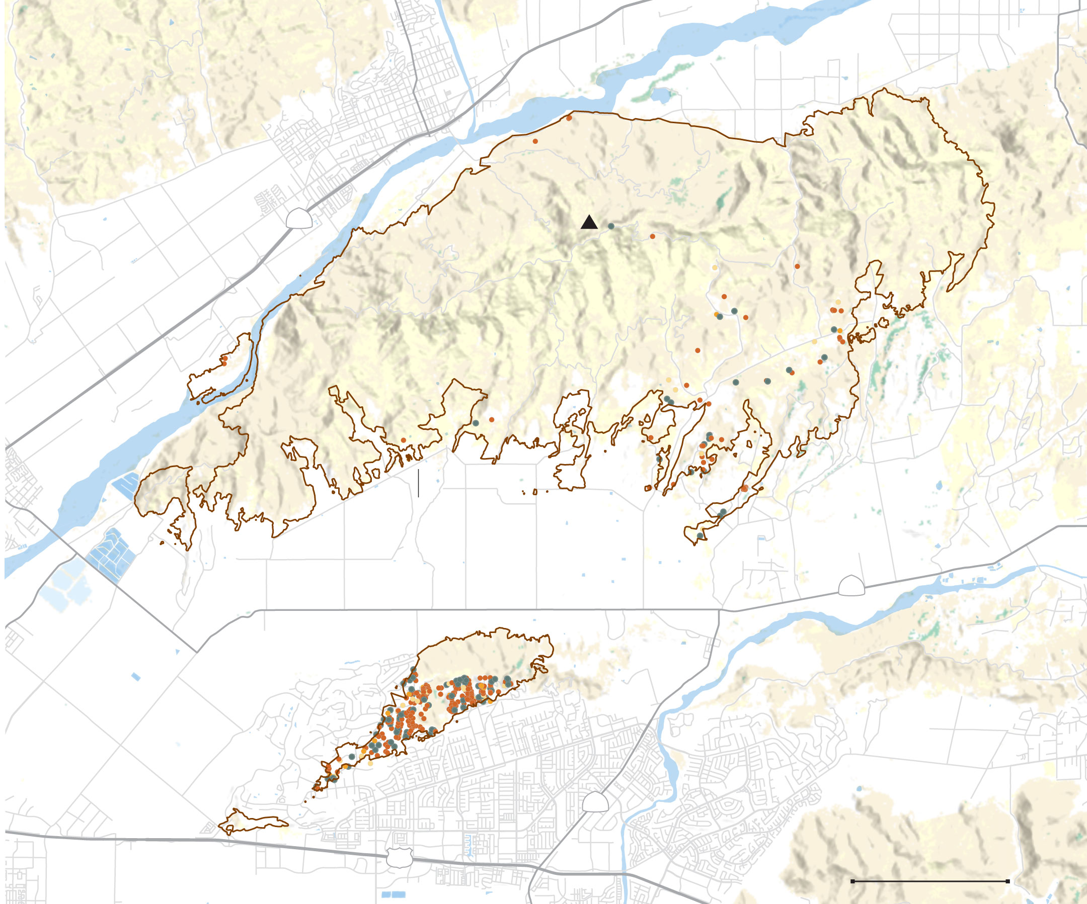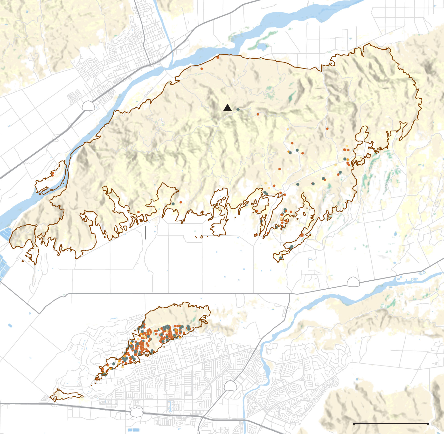
The Mountain fire, driven by powerful winds, razed 243 buildings and damaged dozens more in Camarillo and nearby communities in western Ventura County, according to data released by state fire officials.
The tally places the blaze as the third most destructive wildfire in Southern California since at least 2013.
Ventura County was also the epicenter of the region’s two most devastating recent fires, both sparked by power lines.

The 2017 Thomas fire destroyed over a thousand buildings as it tore through 281,000 acres of Ventura and Santa Barbara counties, becoming the largest wildfire in state history at the time. Two people were killed.
A year later, the Woolsey fire ignited under similarly heavy winds in Simi Valley. The blaze ultimately destroyed 1,600 structures — mostly in Los Angeles County — and killed two people.
The area within the Mountain fire perimeter has seen eight significant wildfires in the last four decades. Most began in the fall, when Santa Ana winds can become particularly dangerous. Southern Ventura County is a “favorable corridor” for dry offshore winds, said Ariel Cohen, the lead meteorologist at the National Weather Service’s Oxnard office.
While the area’s chaparral ecosystem evolved to withstand some wildfire, repeat burns every 10 or so years can create a feedback loop that erases the larger, more resilient shrubs and allows for flammable invasive grasses to take over. That phenomenon was particularly relevant this fall, which saw a hot late summer following two wet years and extreme growth. About 30% of the area burned by the Mountain fire was grassland, according to a Times analysis of land cover data.
“This was definitely an area with very high vulnerability” Cohen said. “Coming out of two water years of 150 to 200% of normal percent precipitation … that’s been able to grow a lot of that vegetation, brush, grasses, that ends up being the base for fires to very efficiently spread.”
Most of the area burned by the Mountain fire was in sparsely populated area in the Santa Susana Mountains north of Highway 118. But early in the fire’s progression on Wednesday, Nov. 6, the blaze jumped the highway and began threatening a suburban neighborhood in the Camarillo Hills. For the next two days, firefighters were on the defensive. When calmer conditions prevailed that Friday, crews were able to focus on containment.

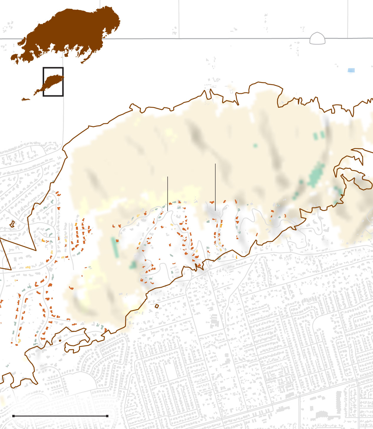
The devastation was concentrated on a handful of streets surveyed by state and county officials.
On Santa Cruz Way, 89% of homes were destroyed or sustained at least minor damage. West Highland Drive saw the highest number of homes severely impacted, with 33 out of 50.


The fire destroyed or severely damaged 20 homes on both sides of Old Coach Drive in Camarillo. (Gina Ferazzi / Los Angeles Times)

W. Highland Drive saw the most destruction. (Brian van der Brug / Los Angeles Times)
Many of the streets in this area are lined by ravines, which can prove particularly dangerous during wind-driven ember fires. Should an ember land at the bottom, fire can can climb uphill on both sides.
“One of the biggest risks that you can take — from a community perspective — is increasing development and the number of people at the wildland-urban interface,” said Alexandra Syphard, senior research scientist at the Conservation Biology Institute and a leading researcher on how to protect homes from wildfire.
Damage percentage
Affected (1-10%)
Minor (10-25%)
Major (25-50%)
Destroyed (50-100%)

Mountain fire
118
Detailed
Camarillo Hills
Santa Cruz Way
W. Highland Dr.
Las Posas Road
0.5 MILE

Mountain fire
118
Detailed
Camarillo Hills
Santa Cruz Way
W. Highland Dr.
Las Posas Road
0.5 MILE
California Department of Forestry and Fire Protection, Ventura County, National Land Cover Dataset, National Hydrography Dataset, U.S. Census, NASA
Sean Greene LOS ANGELES TIMES
At a community meeting on Nov. 10, Ventura County Fire Chief Dustin Gardner and other officials announced a new website where the county would post information about the rebuilding process.
“I know we suffered great damage, but thousands of homes were saved and hundreds of lives were rescued,” Ventura County Fire Chief Dustin Gardner said Sunday night at a community meeting. “We suffered loss, but we’re able to rebuild.”
Staff writers Paloma Esquivel and Matt Hamilton contributed to this story.


